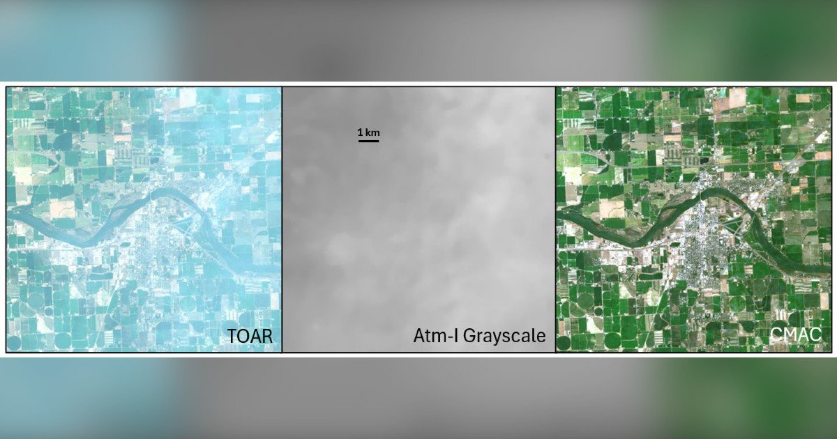
A new open-access paper from Resolv, Inc. argues that precision agriculture has stalled due to unreliable satellite data and high costs, and that both problems can be solved by making accurate surface reflectance the standard output from satellite imagery. The paper, “Surface Reflectance: An Image Standard to Upgrade Precision Agriculture,” was published March 30 in Remote Sensing by Dr. David Groeneveld and Tim Ruggles of Resolv. It benchmarks three atmospheric correction methods on Sentinel-2 imagery and outlines how a reliable correction standard can unlock low-cost, fully automated crop intelligence.
Light traveling through the atmosphere distorts the signal before it reaches a satellite sensor. Atmospheric correction reverses this distortion and returns the data to surface reflectance, the measurement needed for accurate crop analytics. When correction is off, small clouds and shadows can trigger false alarms, and automated analysis has been unable to separate bad data from real trouble. The Resolv team compared Sen2Cor and FORCE against CMAC, a closed-form method developed by Resolv and being readied for commercial release. Across a wide range of atmospheric conditions, CMAC produced precise and accurate surface reflectance estimates, while the two mainstream methods showed systematic bias, over-correcting clear images and under-correcting hazy ones. The bias had gone undetected until this paper surfaced it, as noted in the paper’s findings.
Reliable surface reflectance enables several applications: automated removal of clouds and cloud shadows, an automated crop start-date index that could replace growing-degree-day scheduling, stable NDVI readings even with varying atmospheric water vapor, soil capability classification directly from imagery, and accurate remote crop irrigation based on greenness and reference evapotranspiration. These applications, the paper argues, give precision agriculture a path to paying for itself.
To address high image costs, the paper proposes a tiered model. Tier 1 uses free, high-quality Sentinel-2 imagery corrected to surface reflectance. Tier 2 fills gaps with commercial smallsat data when clouds block Sentinel-2. The smallsat data can be resampled to match Sentinel-2, verified, and billed automatically, with no human in the loop. This could create a turnkey pipeline that orders, corrects, analyzes, tracks, and bills imagery across vast regions without manual touchpoints, sharply reducing service costs while growing image sales volume. Crop insurance could serve as a natural channel, streamlining loss adjustment and bringing more acreage under active management without compromising grower privacy.
Remote sensing has over-promised and under-delivered for agriculture. Reliable surface reflectance imagery, Resolv argues, can finally close the gap. The paper is available open access, and more information about Resolv’s work can be found on their website at https://resolvearth.com. Other peer-reviewed papers are also available for review there.